

Surely several of us have been interested in going for a walk in nature, having closer contact with the forests or the mountains and thus being able to get away from city life for a few hours. Being in contact with the flora and fauna close to us will help us to have a healthier life.
What is hiking?
We can say that hiking is a sporting activity, not competitive, which consists of walking along a path. This trail may or may not be marked, and is generally done along country lanes, greenways, or forest paths.
One of the purposes of hiking is to bring people closer to the natural environment and create awareness through this activity. Anyone can practice hiking, since it adapts to the physical conditions of each person. It has different degrees of technical difficulty and levels of physical effort.
What are the types of hiking that exist?
There are four types of hiking:
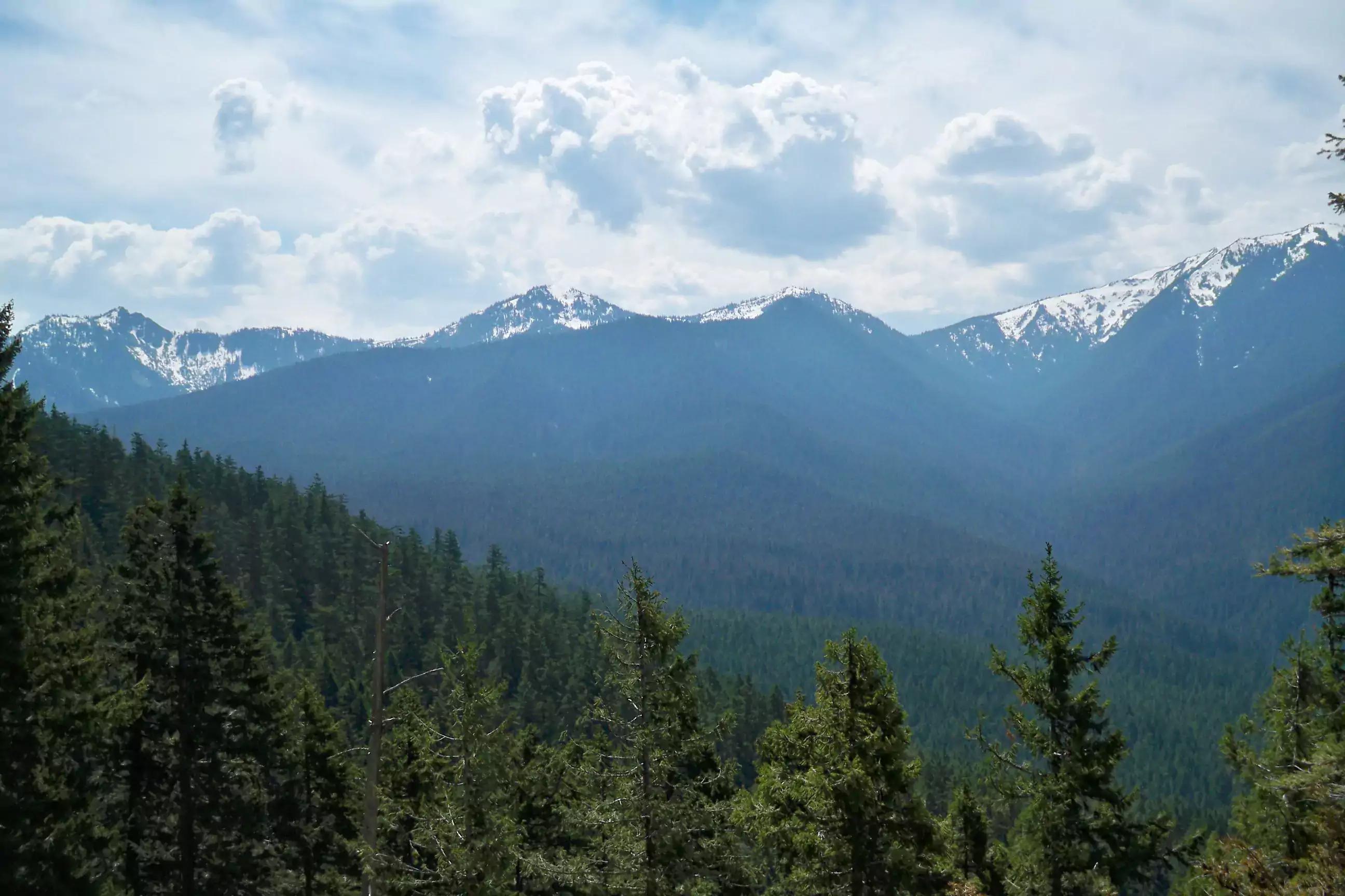
Mountain Hiking
- It is characterized by being carried out in areas of great unevenness, with narrower paths and on different terrains that offer a certain level of difficulty.
Hiking in Nature
- It is carried out on terrain with little unevenness, without large slopes. In general, it is carried out on well-defined paths and with good signage, since its objective is to contemplate the natural panorama of the area.
Fast hiking
- Like mountain hiking, but giving more speed to the walk. The trails may or may not be defined, giving it the allure of having to decide your own path.
Hiking in the Snow
- It is done on snowy trails, not too complicated
What are the types of trails and their signage?
Local trails
They have a short route, less than 10 km and their level of difficulty is low. That makes them suitable for touring with the family, without the need for sophisticated equipment or physical preparation or previous hiking experience.
Short-distance trails
Its extension does not exceed 50 km, so they are designed to be traveled generally in a single day.
Long-distance trails
Any route that exceeds 50 km falls into this category, and they can cross different municipalities or towns. It is usually done over several days.
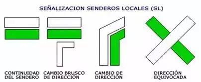
Continuity
- It consists of a white line above and another of the color corresponding to the trail below. If two trails meet at the sign, the one with the highest rank is marked first. In other words, a section common to a GR path and a PR path is marked with a white, red and yellow stripe.
Abrupt change of direction
- Same as the Continuity sign, with an inverted L below in white.
Turn
- Se emplea cuando se deja el camino para tomar otro. Se marca con dos líneas paralelas que simulan la dirección del cambio.
Wrong direction
- It is placed at the beginning of a path that should not be taken. The colors of the path type are used in the form of a cross, with the stripe running from the lower left to the upper right.
What items do I need?
- Backpack
- It should be between 18 and 32 liters in capacity, preferably lightweight and can be strapped across the chest or hip for comfort.
- Footwear
- The sole must be with very good grip and specialized for hiking. Preferably use those that are half boot or full boot. The socks we suggest you use those that are non-slip.
- Outfit
- quick dry pants
- Long-sleeved shirt to protect you from the sun and winds
- Depending on the destination, a sweatshirt and a windbreaker should be added, in the case of cold places it would be best to bring something suitable for low temperatures.
- Accessories
- Light gloves, scarf and hat
- Canes
- Sunscreen
- Class 3 sunglasses, these filter up to 92% of the light, they are used for areas with high luminosity.
- First aid kit
- Water, about two liters per person.
- Food in small portions
- Bag to carry all your garbage
Is it good to take my dog?
Taking your dog with you on a day of hiking is not a bad idea. In fact, hiking with dogs is an activity that strengthens the bond with your pet and with which, without a doubt, you will make them very happy. If your dog loves to go for a walk, imagine how he would like to go on a nature trail for hours. Hiking is a very good exercise for the mind and body, both for you and your furry friend.
To take your best friend for a day of hiking, here are some recommendations:
Plan the route
- You should know in advance the total duration of the trip, the kilometers and everything related to the terrain. You must choose depending on your physical capacity and that of your dog.
Take into account the weather
- It is not advisable to go out on a hot or very rainy day. The best time to go out with your dog is in Autumn.
Choose a route according to the abilities of your dog
- You must take into account the breed, age, physical condition, stamina and health of your canine companion. Do not force him to make a physical effort that could bring negative consequences.
Avoid dangerous areas
- Cliffs, climbing or suspension bridges could be problematic for your dog. Also the asphalt in summer could cause burns on your dog's legs.
Protect your dog's pads
- Use protective cream before and after each route, so you will prevent them from cracking and the dog from getting hurt. It is also advisable to check from time to time, during the tour, that the legs are fine, without cuts or any buried object.
Start small
- Your first routes with your dog should be short and as they get used to it, the difficulty and duration increase.
Bring enough water for both of you
- This way you will avoid dehydration, take a portable drinker or a collapsible silicone feeder to offer water or food from time to time to your faithful companion.
Remember to take short breaks to replenish energy.
What are the best places for hiking in Mexico?
In Mexico there are many hiking trails so it is very difficult to define which would be the best but we will give you a list of some places that are excellent for hiking in various parts of the country.
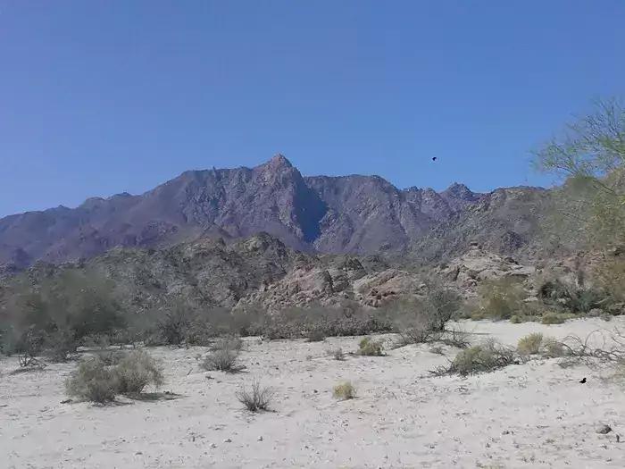
Guadalupe Canyon in Baja California
It is located 60 kilometers south of the Mexicali-Tijuana highway in the state of Baja California, and in it you can find incredible natural wonders hidden in the desert.
You can find hot springs, in addition, it is a perfect place to camp and sleep under the stars, which shine more intensely thanks to the absence of artificial light.
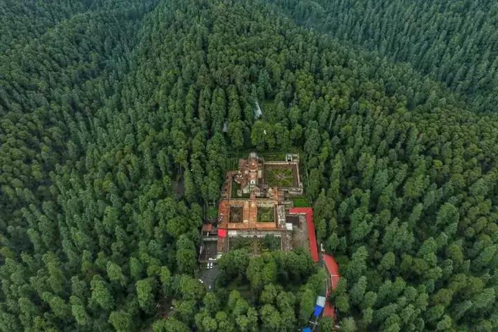
Desert of the Lions in CDMX
The Desierto de los Leones National Park, is one of the most popular and attractive places for hiking, it is very close to CDMX and a large number of hikers, hikers, cyclists and families gather there to explore the steep trails of this beautiful park.
It has trails that vary from moderate to difficult, however they are all easy to follow. The most challenging excursion is the one that heads towards Cerro San Miguel, the highest peak in the park, which is 12,400 feet above sea level.
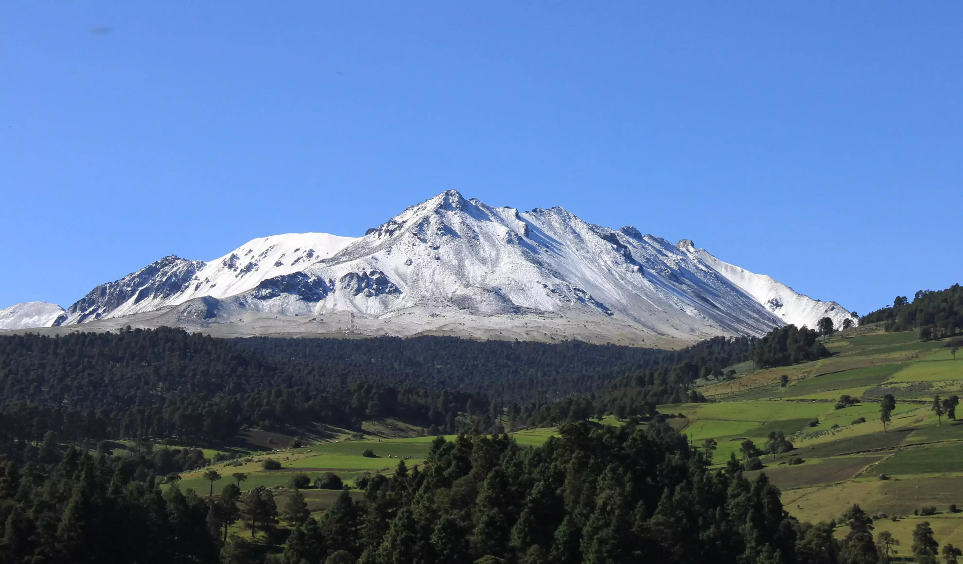
Nevado de Toluca
The Nevado de Toluca is the fourth largest mountain in Mexico, it is ideal for beginners as well as enthusiastic hikers because its walks are adapted to different levels.
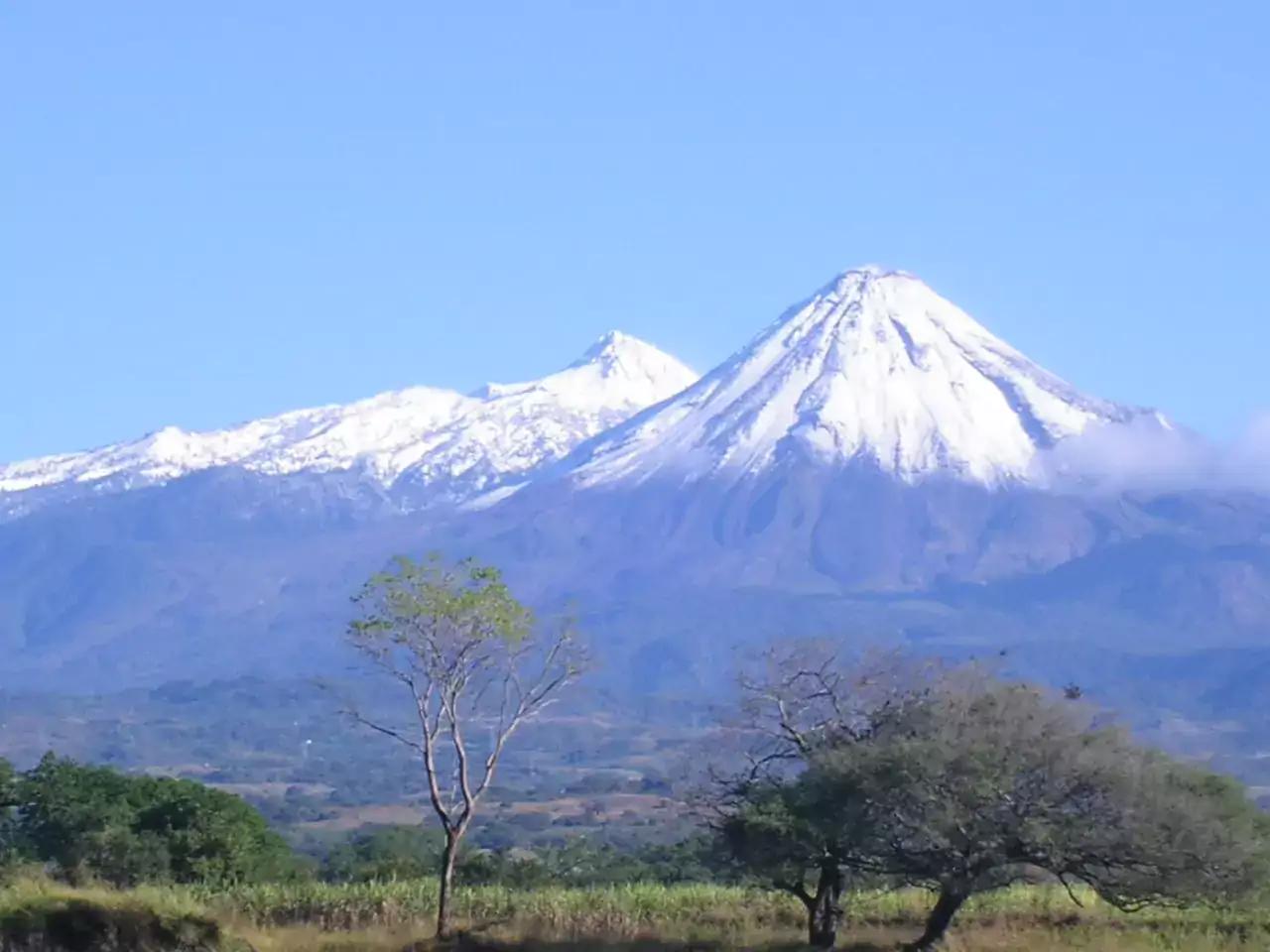
Nevado de Colima
The Nevado de Colima is the seventh highest peak in Mexico, it is an old inactive volcano that is located between Colima and Jalisco. It is located around a protected park, so you can find different routes depending on your level.
Ajusco Summits in CDMX
The Cumbres del Ajusco National Park has well-trodden trails and beautiful landscapes. It is located at an altitude of 4,000 meters above sea level. Several trails converge at the top, so there is no risk of getting lost.
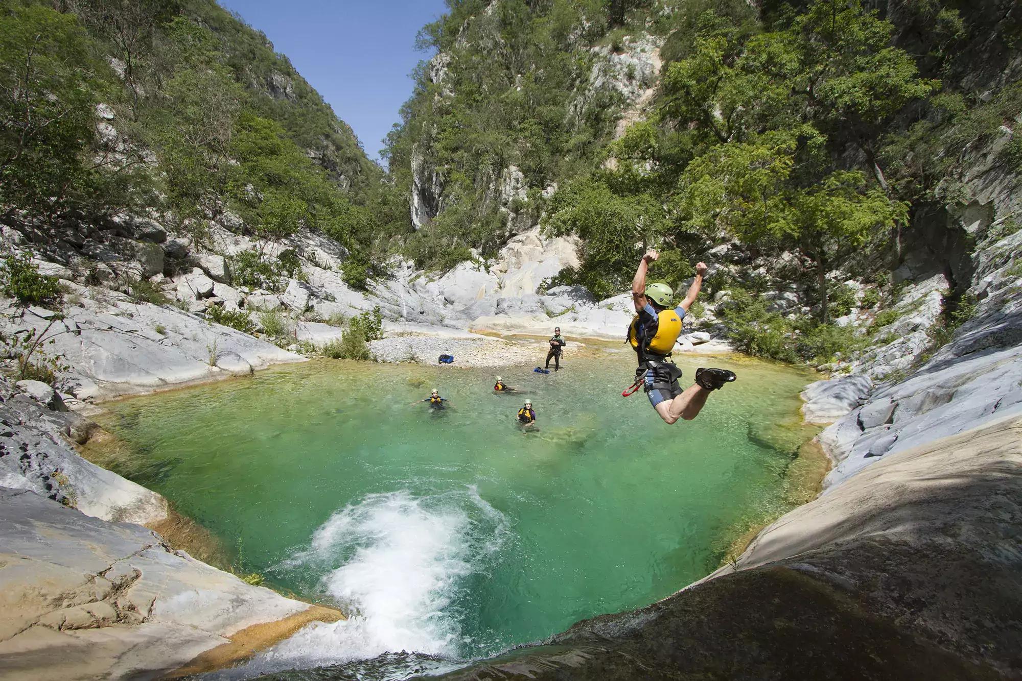
Matacanes in Nuevo León
One of the most spectacular canyons in Mexico is Matacanes and it is located two hours from Monterrey, Nuevo León. In this beautiful place you can find underground rivers, waterfalls and pools of blue water.
Bishop's Hill in Jalisco
This hill is part of the pilgrimage that faithful parishioners make every year to Talpa to give thanks to the Virgen del Rosario de Talpa, but it can be visited at any time. It has a height of 2100 meters and there are several routes that you can take depending on the level you have.
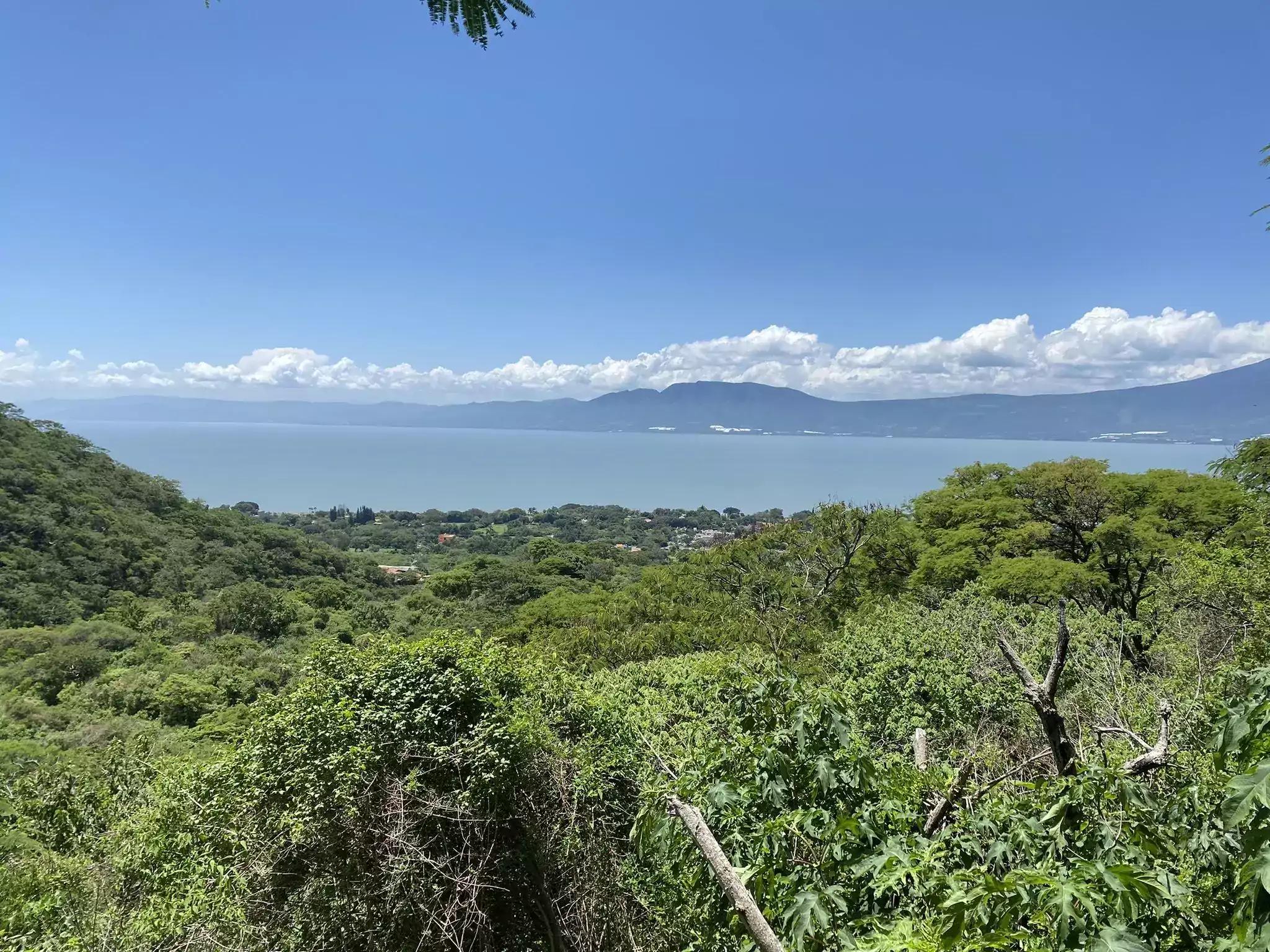
Sierra de San Juan Cosala in Chapala, Jalisco
This mountain range has a beautiful view of Lake Chapala, the largest lake in Mexico. It is located one hour from the city of Guadalajara and has several routes that will allow you to start from the most basic to levels for people with more experience.
Sierra de Santa Rosa in Guanajuato
Just 15 minutes from the capital of Guanajuato is the Sierra de Santa Rosa, an area characterized by its morning fog, this will make your hiking experience completely different.

These are some of the places that you can find in Mexico to go hiking, other places where you can go hiking are
- Caves and waterfalls of Cuetzalan
- The Lacandon Jungle in Chiapas
- Iztaccihuatl volcano
- Los Tuxtlas Biosphere Reserve
- Copper canyons
- Sierra San Miguelito in San Luis Potosi
- Sierra de Órganos National Park in Zacatecas
How do I find hiking trails near me?
There are two very popular apps that will help you find hiking trails near you.
AllTrails
"Your guide to the outside", is how the AllTrails app defines itself, with a catalog of more than 100,000 hiking trails around the world.
There are routes of different levels of difficulty, so you can choose the one that best suits your experience to do it in complete safety.
This app does not lack the saving of activities carried out, to be able to analyze your performance as the days go by, and the detailed GPS itinerary to guide you.
Wikiloc
One of the most useful apps for hiking is Wikiloc, with millions of trails around the world to choose from.
In addition, you can create your own routes and download those that you have liked the most to access them when you do not have a network connection.
After you've finished a trail, you can save the activity and add the photos you've taken along the trail for other Wikiloc users to see.
These are some of our tips and guides to start hiking, do you have other tips or do you think we missed mentioning something? Leave us your opinion in the comments.


comments